
GIS Data Capture
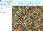
GIS or Geographic Information Systems is a technology that has taken off in the last 10 years. It involves the survey and data capture of features on the ground and enables planners, municipalities and governments too not only manage their assets, but plan for the future developments of these assets. Geosurv can provide GIS practitioners with the survey and capture of these features for them to further develop their databases.
LEARN MORE